Canoe & Kayak
|
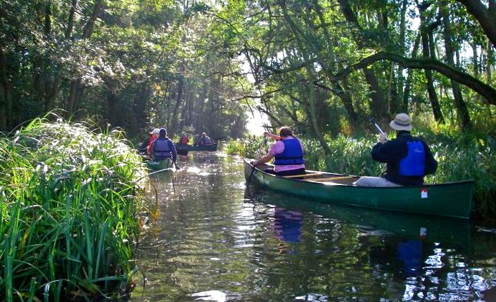
The quiet woodland waters of the Broads and the creeks of the coast are an excellent place to launch your canoe or kayak. |
|
A Guide To Canoeing and Kayaking on the Norfolk Broads
|
|
|
| |
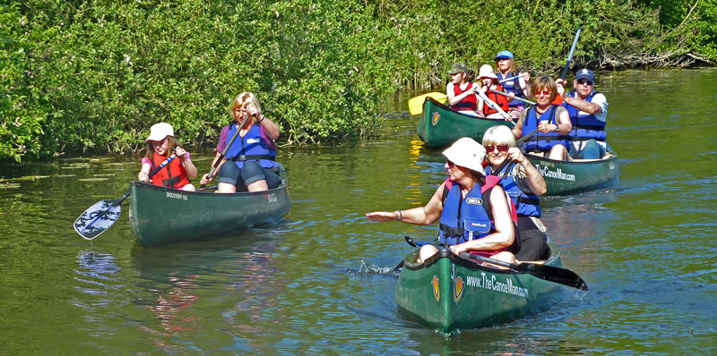
You don’t have to be an experienced canoeist in order to get afloat on the Norfolk Broads you don’t even need to have your own equipment – there are a variety of Hire centres throughout the broads as well as Guided trails that are run on a regular basis. |
| |
The Norfolk and Suffolk Broads and their feeder rivers offer a variety of canoeing opportunities for paddlers of all craft and all levels of experience. The major tributaries outside of the area controlled by the Broads Authority offer canoeing on quiet waters away from powered traffic there is only one company that offers access to these areas – TheCanoeMan.com, whilst the rivers within the Broads system there are numerous canoe hire centres that offer the opportunity to survey this special conservation area and its wildlife from close quarters, albeit in company with other, larger, craft. The Broads themselves offer what can be at times challenging canoeing for the more experienced paddler, particularly during less settled weather, whilst the advanced paddler can find extreme conditions around the mill races on the major rivers and on those rivers and broads subject to strong tidal flows. |
| |
The CanoeMan specialises in offering canoeing on the quietest most tranquil sections of Norfolk’s Rivers they offer Guided Canoe Trails, including Otter & Bittern spotting trails, Canoe camping, Bushcraft trails as well as canoe hire from over 10 locations throughout the Broads. |
| |
|
| |
Canoeing the Norfolk Broads can be broken down into the major river systems as follows: |
| |
River Bure
This is the river system on which the bulk of the Norfolk Broads are found. The river runs from well above Aylsham all the way down to Great Yarmouth. Navigation (the point where larger powered craft cannot go beyond) stops at Horstead mill. Paddling above Buxton is fraught with portages and access challenges. Easiest access at Buxton is via TheCanoeMan’s Canoe Hire centre which provides Canoe Hire, Guided Trails & Parking (at an additional charge for those not hiring equipment) for directions see www.TheCanoeman.com. From here to Coltishall is probably one of the most beautiful stretches of river in the county. The river meanders initially through open grassland and then into a stunning tree line section. There is plenty of wildlife to be seen here from Kingfishers to if you are lucky Otters. From Coltishall onwards you will have to endure the 'pleasure cruisers' ranging from the small electric dayboats all the way up to the 12 berth super cruisers. In reality they pose no threat to the canoeist – officially rule of the river is to stick to the right hand side to pass but so little room is taken up by a canoe that pulling in tight to either side of the river is usually more than enough. The river winds its way from Coltishall to Wroxham. Wroxham often referred to as the capital of the Broads is a buzzing thriving village and many of the boatyards are based in and around Wroxham so motor cruiser traffic will significantly increasing from here on. Leaving Wroxham you will see many of the very expensive riverside holiday homes that are now an established part of the broadland landscape. Below Wroxham is where the main Broads 'run' starts with Wroxham broad, Salhouse broad, Blackhouse broad, Cockshoot broad, Great Hoveton broad. By now the Bure is a large very wide river which in the height of summer can be very busy. Places well worth a visit are the Norfolk Wildlife Trust centre at Ranworth along with Ranworth church said to have the best view over the broads. Soon after passing the turn off for Ranworth the ruined remains of St Benets abbey will be seen on your left – these are well worth a visit if only to see graffiti dating back to the 13th century! Canoeing beyond this point is not recommended as the river is very wide becoming more tidal, exposed to high winds and very very busy. |
| |
River Ant
Starts well above North Walsham but unfortunately the river has little to offer, other than narrow field ditch paddling, until you reach Honing. Access at Honing Lock is somewhat challenging to find and has very limited parking (a maximum of 2 cars). If you intend to use this access point you are better of to arrange a shuttle transport (getting you and your equipment dropped off. Whilst leaving your vehicle at the get out point) this can be arranged via TheCanoeMan. The first half a mile of this trip is along a very narrow reed lined stream which at the wrong time of the year can be a 'jungle warfare' but all good fun. The further along you get the river widens – this is the disused North Walsham Canal – very peaceful and beautiful. Just before you reach the main (A149) road bridge a network of dykes joins from the right. Well worth an explore if you have the time. Immediately on the right after the road bridge is a very easy get out at the Weyford Parish Staithe beside Banks boat there is also parking available here. From here on your likely to encounter more day boats and cruisers but you should still find quieter stretches. The river winds and widens on it way down to Barton Broad just before it enters the broad a tributary enters from the left – this runs down from Stalham where there are several boatyards, a hotel as well as ' The museum of the broads' which is well worth a visit. The Ant runs through Barton Broad a wonderful broad a real haven for wildlife probably Norfolk’s best Otter spotting territories. It is also home to the Norfolk Punt Club and has regular sailing regattas. As with all the broads it is recommended that paddlers should stay close to the windward bank for several reasons but not the least to avoid being run over by a high speed sailing yacht! There is good access and egress as well as parking at Barton Turf and an excellent pub and Tea room at Neatishead accessibly by a small network of dykes marked on the right hand side of the broad. You leave Barton via 'The Shoals” just above Irstead. When you reach Irstead church (on your right) there is a nice green where you can picnic or access or egress. Please be aware the locals have added signs saying no canoes but as this is a Broads Authority key heading access/egress is allowed. The river here is initially quite pleasantly tree lined but soon deteriorates into quite desolate open fields, combine this with the river being relatively narrow, putting you in close proximity to other river users. Having passed by 2 or 3 derelict windmills you will eventually reach Ludham Bridge where there is a small general store, boatyard and 200yds down the road a pub. The river before Ludham bridge is generally of little interest and tends to be quite busy at peak times. The Ant finally joins the Bure just before St. Benets Abbey. |
| |
|
| |
River Yare
As a canoeing river the Yare is very much a river of 2 halves – The highest point of easy entry is Bawburgh and the run down for the first couple of miles is truly jungle warfare and at the wrong time of year virtually impossible. From Earlham church initially the river can be very shallow but quickly deepens into a very pleasant tree lined meander running behind the UEA. Next bridge in Cringleford where access/egress is easy long as you can carry the 300 meters to the small car park. From here on down the Yare become more challenging – despite a pretty river – negotiating the next three miles as Keswick, Lakesham and Trowse can prove hard work and is not for the fainthearted. The Yare starts to widen and soon is joined by the Wensum and suddenly turns into a very big, wide and tidal river. The final run from Whitlingham to Thorpe green is pleasant enough especially as it finishes beside the local hostelry! By this point the Yare is of no real interest to most paddlers being wide and flat and exposed there are however a couple of areas of interest and worth a visit in their own right and that is Rockland & Surlingham broads. Beyond the Whittlingham the river becomes more tidal and is unsuitable for less experienced paddlers. |
| |
River Wensum
Undoubtedly one of, if not, the most beautiful paddling river in Norfolk. Starting high above Fakenham the Wensum winds its way through beautiful unspoiled Norfolk Countryside – the top sections from Fakenham down are more suited to the experienced paddler as regularly trees block the river or convoluted portages are required to bypass the many mills on route. The Wensum is the only river in Norfolk to hold barbel and a good head of trout which unfortunately makes it an angling paradise this has and continues to cause friction between paddlers and fishermen. The lower section are more often paddled with the section from Attlebridge down being quite popular despite a 400yd portage in the middle! It is worth contacting either the river access officer or TheCanoeMan prior to paddling this stretch to get an up to date picture. The river continues to meander through open farmland working its way closer and closer to Norwich. The head of the navigation is at New Mills Yard where a portage is required through a housing estate! After this the river runs right through the centre of the city (which makes for a very pretty night time paddle) before joining the Yare. |
| |
River Waveney
Meandering along the Norfolk, Suffolk border is the very pretty river Waveney. The upper sections are clear and gently flowing and offer a haven for all sort of wildlife – Otter sightings are not uncommon. Scole is an easy access point, from here down there are relatively easy access, egress points for most of the way along the river – in the last few years there has been an excellent guide to canoeing the Waveney written in conjunction with The Environment Agency and is well worth getting a copy. Similar information can be found within TheCanoeMan guide to canoeing and kayaking in Norfolk and Suffolk. The stretch from Ellingham Mill down is still somewhat contentious despite many attempts over the years to negotiate an access agreement with the angling club who own the fishing rights. The highest point of navigation for motor launches is Geldeston Lock (the site of an excellent pub) and you will notice a significant change in the river from this point on as it widens, deepens and becomes more tidal. The river continues past Beccles and Bungay heading towards Oulton Broad and ultimately the sea. Below Bungay the river holds little interest to the paddler.
|
| |
|
| |
|
THREE Other Places to go Canoeing and Kayaking in Norfolk
|
|
This woodland and water park just southeast outside Norwich at Trowse is a great place to walk, cycle, canoe, picnic or birdwatch. Built on the site of a quarry whose gravel was used for a number of major local construction projects, Whitlingham offers a full range of water-based activities, including moth and bat evenings, pond dipping, quarry safaris and a Canadian canoe trail. A historic flint barn has been converted into a visitor information centre, cafe and WC. |
|
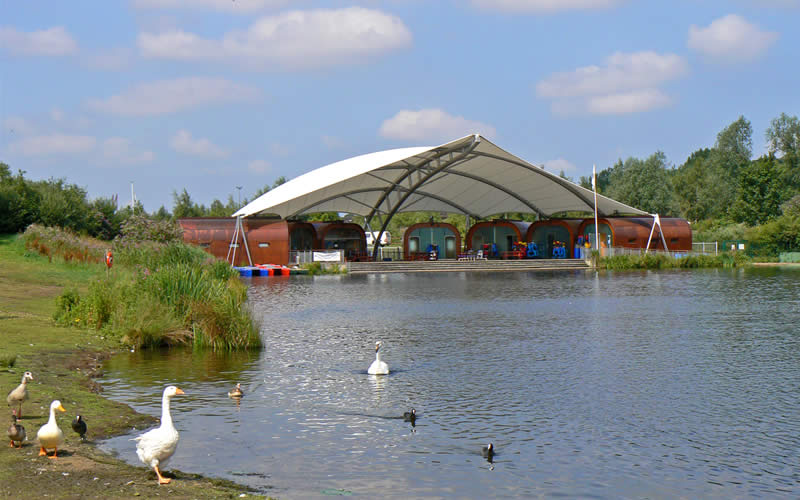
Whitlingham outdoor education and adventure centre |
| |
|
|
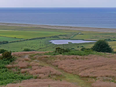
Wells next the sea is situated a good mile or so from open water. Like many places along this stretch of the Norfolk Norfolk Coast, silting has limited access to the sea, but back in Tudor times, Wells was one of the great ports of eastern England. It’s still one of the most attractive towns on the North Norfolk coast, and the only one to remain a commercially viable port. It features many narrow creeks nicely sheltered from the offshore winds and makes a very good base for exploring the surrounding coastline. |
|
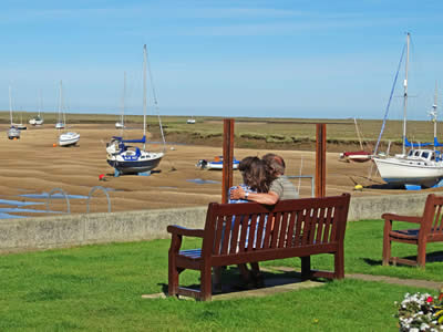
A creek from the harbour at Wells |
| |
|
|
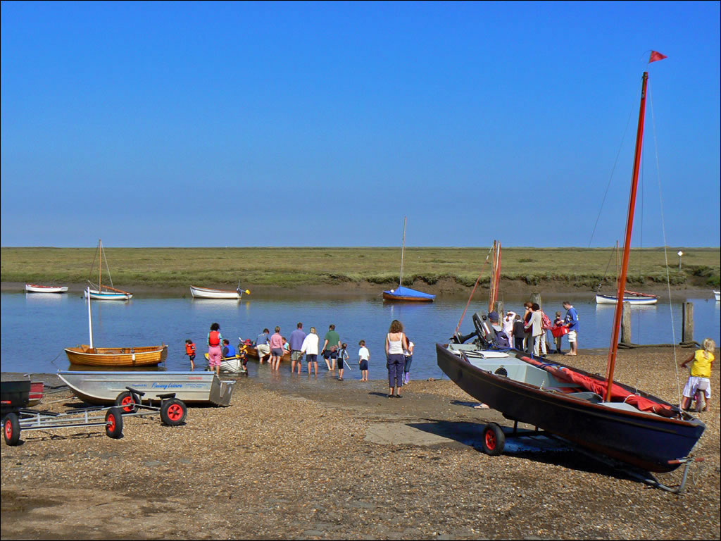
At Burnham Overy Staithe, there is plenty of launching facilities for boats of all kinds. The village of Burnham Overy has moved over the years, as the channel gradually silted up sea going vessels had to moor further and further downstream, until over time the majority of the population had moved from Burnham Overy Town to Burnham Overy Staithe. Today it is a mecca for boating enthusiasts, with plenty of paths for those who prefer to remain on land! |
|
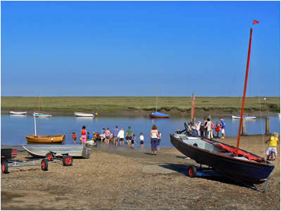
Launching a boats at Burnham Overy Staithe |
|
NORFOLK PICTURE TOURS |
|
|
|
|
|
|
|
MORE OF OUR WEBSITES |
 |
 |
 |
| |
|